Note: Unfortunately, at this time, none have public markers.
Specific Locations of Native sites on the
Once As It Was Map of Washington, DC


Joint Base Anacostia-Bolling, near Geisboro Park
Note: Public is not allowed to enter the Base.
7th - 8th St & Virginia Ave, SE


Joint Base Anacostia-Bolling, near Geisboro Park
Note: Public is not allowed to enter the Base.
Joint Base Anacostia-Bolling, near Geisboro Park
Note: Public is not allowed to enter the Base.
Below 15th & L Sts, SE


2nd & R Sts SW
South Lawn
Anacostia river bank, below Hickey Hill


Banks of Piney Branch Creek near 16th St bridge, NW
Connecticut Ave & Albermarle Sts, NW
15th St between Constitution and Independence Aves, NW
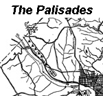


Battery Kemble Trail, accessible on MacArthur Blvd and Chain Bridge Rd
Under the handicapped accessible walkway
4940 Canal Rd NW. Washington, DC 20007
Birch Collection in Boy Scout Room of Palisades Commuity Church, 5200 Cathedral Ave NW, Washington, DC 20016 (contact the church for possible viewing)

Ramp North of Thompson Boat House parking lot below the Whitehurst Freeway
Washington, DC